
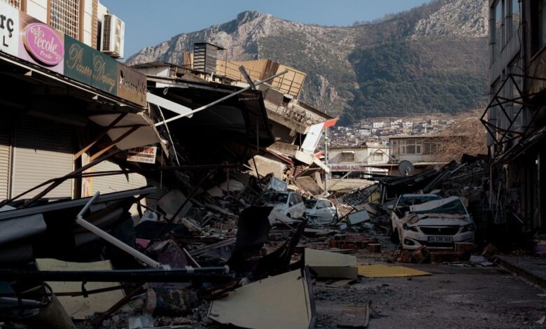
On November 15, 2024, the Earth’s crust decided to remind us who’s really in charge. Four powerful earthquakes—ranging from magnitude 6.2 to 6.8—struck within just eight hours across different regions of the Pacific Ring of Fire. The question that seismologists and concerned citizens alike were asking: were these earthquake clusters simply a statistical anomaly, or was something deeper connecting them?
This wasn’t the first time multiple major quakes rattled the planet in quick succession, but the concentration and timing made this particular earthquake cluster worth examining closely. Understanding how to analyze these events separates informed interpretation from panic-driven speculation.
Step 1: Gather Location and Magnitude Data for Each Event
Before drawing any conclusions about earthquake clusters, you need precise information. The four quakes in question struck:
- Off the coast of Peru (magnitude 6.8) at 09:14 UTC
- Near Fiji (magnitude 6.4) at 12:07 UTC
- In Vanuatu (magnitude 6.6) at 14:35 UTC
- Off the Solomon Islands (magnitude 6.2) at 17:08 UTC
The distances matter enormously. Peru to Fiji spans roughly 9,000 kilometers. Fiji to Vanuatu covers about 2,000 kilometers. These aren’t neighboring faults. They’re separated by thousands of kilometers of ocean and different tectonic plate boundaries. This geographic distribution is your first clue about whether you’re looking at a genuine earthquake cluster or merely a coincidence.
Pull data from the U.S. Geological Survey (USGS) Earthquake Hazards Program or the European-Mediterranean Seismological Centre (EMSC). These organizations provide real-time magnitude calculations, depth measurements, and focal mechanisms—the direction and type of fault movement. Don’t rely on social media reports or unverified sources; seismic data changes as instruments process waves from around the planet.
Step 2: Examine Tectonic Plate Boundaries and Fault Lines
Doruk Aksel Anıl
Here’s where geology matters. All four of these earthquakes occurred along the Pacific Ring of Fire, a 40,000-kilometer horseshoe of subduction zones, transform faults, and volcanic activity that accounts for roughly 75% of the world’s major earthquakes. That’s not a connection—that’s just where earthquakes happen most often.
The Peru quake struck at the Peru-Chile Trench, where the Nazca Plate descends beneath the South American Plate. The Fiji and Vanuatu quakes occurred at subduction zones in the Southwest Pacific. The Solomon Islands quake happened at a different subduction zone entirely. Each has its own distinct tectonic mechanics. They’re not part of the same fault system, and the stresses that trigger them don’t directly transfer between these distant regions.
When analyzing earthquake clusters, map the specific fault systems involved. Are the quakes on the same fault, neighboring segments of the same fault, or completely separate structures? The answer determines everything about interpretation. A cluster on adjacent segments of the San Andreas Fault could indicate stress transfer. Four quakes on four different subduction zones spread across 13,000 kilometers? That’s statistical clustering, not mechanical coupling.
Step 3: Calculate Magnitude-Frequency Relationships and Background Seismicity
Earthquakes follow the Gutenberg-Richter law, which describes how frequency and magnitude relate. For every magnitude 7 earthquake, you expect roughly 15 magnitude 6 earthquakes and 130 magnitude 5 earthquakes. This isn’t about causation; it’s about probability.
The USGS reports approximately 1,350 magnitude 6 or greater earthquakes annually. That works out to roughly 3.7 magnitude 6+ quakes per day, on average, somewhere on Earth. Four major quakes in eight hours exceeds the daily average, yes—but Earth’s seismic activity fluctuates. Some weeks see seven magnitude 6+ events; other weeks see one.
Check the historical frequency for each specific region. The Solomon Islands region averages one magnitude 6+ earthquake every few months. Peru’s subduction zone sees multiple magnitude 6+ events yearly. These are high-seismicity areas. What would be shocking in Kansas or Sweden is routine in Vanuatu. Context matters when evaluating whether earthquake clusters represent genuine anomalies.
Calculate the probability using binomial statistics. With 1,350 magnitude 6+ quakes yearly and distributed across all active regions, the odds of four landing within eight hours—while statistically unlikely on any given day—aren’t improbable over any given year.
Step 4: Analyze Foreshock and Aftershock Patterns
If earthquake clusters were mechanically connected, you’d expect a signature pattern: a large mainshock followed by smaller aftershocks in proximity. That’s not what happened here. Each location had its own seismic sequence with magnitude 5 foreshocks and aftershocks near each epicenter, but nothing suggesting one quake triggered the others.
The Peru quake produced foreshocks in the preceding days and aftershocks clustered near the epicenter. Same with Fiji, Vanuatu, and the Solomon Islands. There were no magnitude 5 or 6 earthquakes recorded between these locations during this timeframe. If stress had transferred from Peru to Fiji to Vanuatu, seismologists would expect either a cascade of triggered earthquakes or large seismic waves traveling between regions. Neither occurred.
When examining any earthquake cluster, look at the temporal distribution of foreshocks and aftershocks. Do they cluster around each mainshock independently, or is there a progression suggesting one event influenced the others? Use the USGS Earthquake Hazards Program to map these sequences. Plot magnitude over time. Independent clusters show distinct peaks; connected sequences show energy migration.
Step 5: Consult Seismologist Assessments and Peer-Reviewed Literature
After this November sequence, the seismological consensus was straightforward: this was a temporal cluster, not a dynamic cluster. Temporal clustering means multiple large earthquakes happened to occur in the same time window. Dynamic clustering means one earthquake mechanically triggered others. The distinction is critical.
The USGS and EMSC released statements clarifying that these earthquakes occurred on separate, distant fault systems with no evidence of stress transfer. Major subduction zones operate on different timescales and stress cycles. The Peru Trench might be releasing accumulated stress in this cycle while the Fiji zone is simply following its own rhythm.
This echoes similar events from seismic history. In February 2011, four magnitude 6+ earthquakes struck within six days—Christchurch (6.3), Myanmar (6.8), Japan (6.6), and New Zealand (6.1)—again spread across different continents and fault systems. Scientists examined whether these represented global stress redistribution or coincidence. The consensus: coincidence. The Earth’s crust contains so many active faults that clustering sometimes happens purely by chance.
Troubleshooting Common Misinterpretations
Mistake: Assuming Ring of Fire activity means one connected system. The Ring of Fire is a geographic description of high seismicity, not a single tectonic structure. Its hundreds of fault segments operate independently with different stress accumulation rates, slip rates, and rupture cycles.
Mistake: Interpreting media headlines as scientific analysis. Sensational framing—’Earth shaken by unprecedented quake cluster’—conflates unusual with significant. The USGS, which operates the world’s most sophisticated seismic networks, noted nothing unprecedented about this sequence. Unusual relative to daily experience? Yes. Unusual relative to annual seismic activity? No.
Mistake: Believing this predicts larger quakes ahead. Some propose that earthquake clusters precede great earthquakes or indicate global stress buildup. Seismic monitoring shows no evidence for this. Large earthquakes are preceded by small foreshocks in limited geographic areas, not worldwide clusters.
Mistake: Overlooking confirmation bias in pattern-seeking. Humans excel at spotting patterns—sometimes where none exist. If you begin with the assumption that these quakes must be connected, you’ll unconsciously filter information supporting that conclusion while dismissing contradicting evidence. Start instead with the null hypothesis: they’re independent events occurring randomly across time.
Key Takeaways for Understanding Earthquake Clusters
First, earthquake clusters happen regularly on our active planet. With roughly 1,350 magnitude 6+ earthquakes yearly across the globe’s fault systems, substantial temporal clustering is inevitable. This particular event fell within expected statistical variation.
Second, location is everything. Earthquake clusters separated by thousands of kilometers across different tectonic plate boundaries are almost certainly independent. Clusters on the same fault or neighboring fault segments warrant closer mechanical analysis.
Third, consult primary sources. The USGS Earthquake Hazards Program, EMSC, and peer-reviewed seismology journals provide rigorous analysis. Media coverage and social media speculation are unreliable for technical questions.
Finally, understand your own uncertainty. Seismology remains imprecise about earthquake prediction and long-term stress distribution. If experts can’t extract mechanical connections from sophisticated instruments, be skeptical of confident interpretations elsewhere.
Frequently Asked Questions
Were the four earthquakes in 8 hours connected to each other?
No. Seismologists confirmed these were independent events occurring on different fault systems thousands of kilometers apart. Each earthquake had its own foreshock and aftershock sequence with no evidence of stress transfer between regions. They were a temporal cluster—happening near the same time—not a dynamic cluster where one triggered the others.
How often do four magnitude 6+ earthquakes happen within 8 hours?
With approximately 1,350 magnitude 6+ earthquakes yearly worldwide, roughly 3.7 occur daily on average. Four in eight hours exceeds a single day’s typical average but falls within normal statistical variation across the year. Similar clustering events have occurred multiple times in the 21st century without indicating unusual geological conditions.
Does an earthquake cluster mean a bigger earthquake is coming?
No. Seismic research shows no evidence that temporal earthquake clusters predict larger quakes or indicate global stress buildup. Large earthquakes are preceded by small foreshocks in limited geographic areas near the eventual epicenter, not by worldwide earthquake clusters months or years earlier.
Why do so many earthquakes happen along the Pacific Ring of Fire?
The Ring of Fire encompasses subduction zones where oceanic plates descend beneath continental plates, generating the most seismic energy on Earth. This 40,000-kilometer zone accounts for roughly 75% of the world’s major earthquakes because it’s where the planet’s most active plate boundaries are concentrated.
How do seismologists determine if earthquakes are mechanically connected?
They examine epicenter proximity, fault geometry, foreshock and aftershock patterns, and focal mechanisms showing how the fault ruptured. If earthquakes are mechanically connected, you’d see them on the same fault or adjacent segments with one triggering smaller earthquakes nearby. Quakes on separate faults thousands of kilometers apart are independent.
Should I be concerned about increased earthquake activity after a cluster?
No. After temporal earthquake clusters on different fault systems, seismic activity returns to regional baseline rates. Monitor your local earthquake hazards through USGS resources and maintain basic earthquake preparedness, but clusters across distant regions don’t increase risk in any specific location.